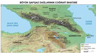
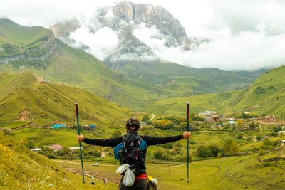
Beginning along the shores of the Caspian Sea, Azerbaijan’s mountain systems encompass a unique natural landscape stretching from the majestic Main and Lateral ranges of the Greater Caucasus to the relic forests of the Talysh Mountains in the south. The country’s highest point, Mount Bazarduzu (4,466 m), the steep limestone massif of Mount Shahdagh (4,243 m), and deep canyons shape the region’s diverse geological relief. Rising directly from the Caspian coast, which lies below sea level, to alpine peaks and glaciers reaching over 4,000 metres, this belt presents some of the most dramatic orographic contrasts of the Eastern Caucasus. On our website, you can explore accurate geographical information about the main mountain ranges of the Caspian Basin, peak elevations, and tectonic features.
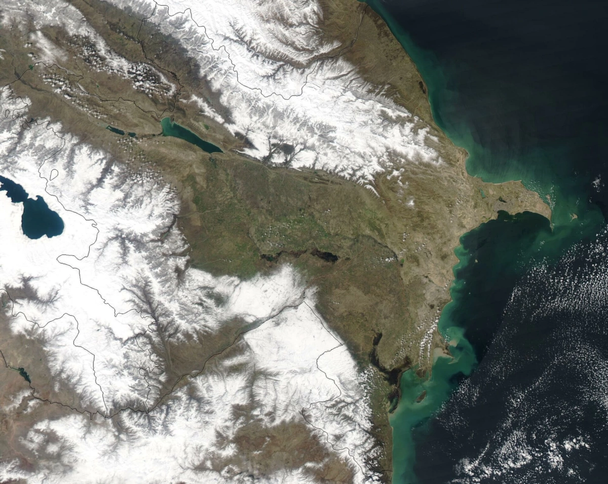
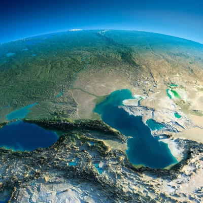
The Caspian Sea is a closed basin located approximately 28 meters below global sea level. Within Azerbaijan, two distinct orographic systems rise directly from this negative-elevation coastline: the Greater Caucasus Range in the northeast and the Talysh Mountains in the southwest. These two mountain systems differ significantly in terms of geological origin, tectonic structure, climatic characteristics, and landscape differentiation.
Caspian Slopes of the Greater Caucasus (Northeastern Sector)
The Greater Caucasus is part of the Alpine-Himalayan fold belt and descends stepwise toward the Caspian Sea. From the Guba-Gusar piedmont plain, the terrain rises within a short distance into an alpine zone exceeding 4,000 meters.
Oromorphological Structure and Main Peaks
The relief of this sector is defined by two parallel ranges:
Main Caucasus Range (Watershed Range)
The range extends approximately 1,200 km from the Caspian Sea, beginning from the western foothills of the Absheron Peninsula, to the Black Sea coast at the Taman Peninsula. It spans the territories of Azerbaijan, Russia, and Georgia, forming the main natural oromorphological and climatic boundary between the basins of the Black Sea and Caspian Sea, as well as between the North Caucasus and South Caucasus.
Main Peaks and Elevations: Bazarduzu (4,466 m), the highest point in Azerbaijan, as well as the Tufandag (4,191 m), Bazaryurd (4,126 m), and Yarudag (4,116 m) massifs are located along the watershed line of this range or on adjacent branches.
Geological Structure: The range consists mainly of fragmented clay shales from the Lower and Middle Jurassic periods, hard sandstones, and local granite intrusions.
Relief Dynamics: Unlike the monolithic limestone plateaus of the Lateral Range, the Main Caucasus Range is characterized by sharply dissected ridge relief, moraine ridges, cirques, narrow passes, and rock flows (moraines) resulting from the erosion of shale and sandstone layers.
Lateral Range
Starting from Mount Beshbarmag on the Caspian coast, the Lateral Range extends northwestward parallel to the Main Caucasus Range and forms an asymmetric cuesta-type limestone massif. Its main morphological and tectonic characteristics are:
Structure and Relief: The northern and northeastern slopes are relatively gentle, while the southern and southwestern slopes are formed by steep rock walls in the form of cuestas.
Main Peaks and Plateaus: Its highest sections consist of enormous plateau-like massifs formed from thick, massive Cretaceous limestone and dolomite: Mount Shahdag (4,243 m) and Gizilgaya (3,726 m). The range continues northwestward to the Shalbuzdag (4,142 m) massif; beyond this zone, the relief gradually decreases, while the monolithic limestone cliffs and sharply rocky morphological forms weaken and gradually transition into softer relief forms and piedmont ridges.
Geology and Canyons: Due to the dominance of carbonate rocks, karst caves, deep cirques, and vertical fissures are widespread in the area. The Qudialchay, Qudyelchay, Gusarchay, and Valvalachay rivers cut across this limestone massif, forming narrow, deep, and steep-sided canyons, including the Tengaltı Gorge and Gryz Gorge.
Starting Point (Beshbarmag): Near the Caspian coast, it begins at an elevation close to sea level as an isolated rocky cuesta outcrop and rises westward to an alpine zone exceeding 4,000 meters.
Hydrography and Climate
River Network: Fed by high mountain peaks, the Girdimanchay, Qudialchay, Gusarсhay, and Valvalachay rivers carve deep canyons along the valleys before flowing into the Caspian Sea. Above 3,500 meters, nival-glacial landforms, moraine ridges, and cirques, such as the Tufangol cirque, are present.
Climatic Characteristics: With increasing elevation, the climate transitions from temperate-warm conditions to mountain-tundra and permanent-frost climates. Cold and humid air masses entering from the Caspian Sea encounter the steep walls of the Lateral Range, producing sudden fog, heavy snowfall, and sharp temperature drops.
Talysh Mountains (Southwestern Sector)
Rising immediately beyond the Lankaran Lowland in southeastern Azerbaijan, the Talysh Mountains form the northwestern continuation of the Alborz mountain system. Unlike the Greater Caucasus, they have no modern glaciation, nival zone, or karst relief.
Oromorphological Structure and Peaks
The Talysh mountain system consists of three main ranges extending parallel to one another from northwest to southeast:
Talysh Watershed Range: Extending along the border with Iran, it contains the highest points of the system: Mount Kəmürgöy (2,492 m) and Gizilyurdu (2,433 m).
Peshtasar Range: Located in the central part, it reaches elevations of up to 2,200 meters.
Burovar Range: The lowest-elevation belt closest to the Lankaran Lowland and the Caspian coast, generally ranging from 600 to 1,000 meters.
Geology: It consists mainly of Paleogene and Neogene volcanic-sedimentary rocks, including andesites, basalts, tuffs, and sandstones.
Climate and Vegetation Inversion
Climatic Influence of the Caspian Sea: Moist easterly and northeasterly air currents evaporated from the Caspian Sea strike the slopes of the Talysh Mountains and bring more than 1,200–1,700 mm of precipitation annually. This is the wettest region of Azerbaijan.
Hyrcanian Relict Flora: Tertiary-period relicts that survived the Quaternary glaciation dominate the vegetation: Persian ironwood (Parrotia persica), chestnut-leaved oak (Quercus castaneifolia), Lankaran acacia, and Hyrcanian boxwood.
Inversion of Vertical Zonation: Unlike typical mountainous areas, humidity decreases with increasing elevation in the Talysh Mountains. While the foothill and middle-mountain belts are covered by humid forests, dry mountain-xerophytic and steppe vegetation develops on plateaus above 1,800 meters.
Geographical and Geomorphological Comparison
|
Indicator |
Greater Caucasus (Caspian Slope) |
Talysh Mountains |
|
Affiliation |
Greater Caucasus fold system |
Branch of the Alborz mountain arc |
|
Maximum Elevation |
4,466 m (Bazarduzu) |
2,492 m (Kəmürgöy) |
|
Rock Composition |
Jurassic shales, Cretaceous limestones |
Paleogene-Neogene volcanic rocks |
|
Glacial Relief |
Present (karst, cirques, moraines) |
Absent |
|
Annual Precipitation Distribution |
Increases with elevation |
Maximum along the coast and slopes, dry at the summits |
|
Dominant Forest Type |
Caucasian beech, hornbeam, oak |
Relict Hyrcanian forests (ironwood, etc.) |
|
High-Elevation Landscape |
Subalpine, alpine meadows, nival-rocky zones |
Mountain-steppe, xerophytic shrubs, and highland pastures |