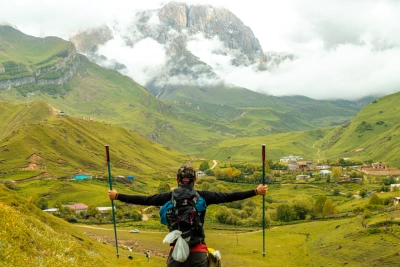
Mount Charundağ (4,079 m) is one of the magnificent peaks rising above 4,000 metres in northwestern Azerbaijan, located in the Main Caucasus Range of the Greater Caucasus. Situated on the Azerbaijan–Russia border, Charundağ lies within the same high-mountain massif as Mount Bazardüzü and Mount Ragdan. Known for the Charun and Mullar canyons, rocky slopes, and rugged alpine terrain, this mountain is a particularly notable destination for mountaineering and mountain trekking.
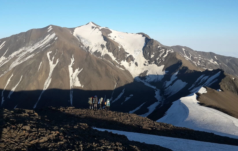
Mount Charundağ (4,079.5 m), rising in northwestern Azerbaijan near the border between the Gabala and Oghuz districts and the Dokuzpara District of the Republic of Dagestan, Russian Federation, is one of the most spectacular and lesser-known high mountain peaks of the Greater Caucasus. With its rugged terrain, rocky slopes, deep canyons, and high-mountain landscape, Charundağ holds a special place in Azerbaijan's mountaineering and mountain geography.
Where Is Mount Charundağ Located?
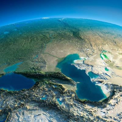
Mount Charundağ is located in northwestern Azerbaijan, in the high-mountain zone of the Main Caucasus Range. The summit lies in a mountainous area crossed by the state border between the Republic of Azerbaijan and the Russian Federation.
Known as Charundağ in Azerbaijani and ЧIарун сув in the Lezgian language, this peak is situated near the high-mountain massif that includes Mount Bazardüzü and Mount Ragdan.
At an elevation of 4,079 metres, Charundağ is among Azerbaijan's peaks rising above 4,000 metres and is considered one of the significant summits in one of the highest mountainous areas of the Greater Caucasus.
Mount Charundağ and the Main Caucasus Range
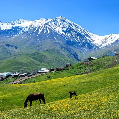
Charundağ is a characteristic example of the rugged high-mountain terrain of the Main Caucasus Range. As elevation increases, the landscape changes, slopes become steeper, and rocky areas become more extensive.
The high peaks and mountain ridges surrounding Charundağ create a distinctive alpine landscape. Its proximity to towering summits such as Bazardüzü and Ragdan makes Charundağ part of an important mountain massif in this section of the Caucasus.
The State Border Crosses the Summit of Charundağ
One of Charundağ's most notable features is that the state border between the Republic of Azerbaijan and the Russian Federation passes through its summit.
This feature makes the mountain significant not only from a mountaineering and geographical perspective but also in terms of Azerbaijan's border geography. Charundağ is an important natural feature of the border landscape in this high-mountain region.
Charun Plateau and Canyons
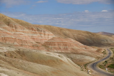
The Charun Plateau, located on the slopes of Charundağ, is a striking example of the region's high-mountain terrain. Over many years, water flowing from the summit and surrounding mountain ridges has eroded the area's hard rocky formations, creating deep valleys and canyons.
The Charun and Mullar canyons are particularly noteworthy natural features of the area.
Charun Canyon
Approximately 5 kilometres long, Charun Canyon is one of the area's most interesting geomorphological features in Dagestan. Steep cliffs and narrow passages give the canyon a wild, untouched appearance.
Mullar Canyon
Approximately 5 kilometres long, Mullar Canyon is another remarkable natural feature of the Charundağ area. Along the canyon, there are waterfalls reaching 7–8 metres in height.
The rugged mountain terrain, deep valleys, and waterfalls make this area fascinating for both nature research and mountain expeditions.
Mount Charundağ – A Challenging Peak for Mountaineers
At an elevation of 4,079 metres, Charundağ stands out not only for its height but also for its complex terrain and demanding high-mountain conditions. Rocky slopes, steep passages, long distances, and changeable weather mean that an expedition to the summit requires serious physical and technical preparation.
One of the main approaches to Charundağ from the Azerbaijani side begins in the village of Khinalig, continues towards Bazardüzü, and then follows the Main Caucasus Watershed Range towards the summit. The high-altitude conditions and long distance make this route particularly demanding. Another possible approach is from the direction of Filfilli village in the Gabala district. This route also requires thorough preparation due to its distance, terrain, and high-mountain conditions.
When climbing Charundağ, altitude, weather conditions, terrain characteristics, and the technical difficulties of the route must all be considered in advance. Therefore, expedition planning should include an experienced mountain guide, an assessment of weather and route conditions, and the selection of appropriate mountaineering equipment.
Charundağ and Azerbaijan's 4,000-Metre Peaks
Several significant peaks rising above 4,000 metres are located in the Greater Caucasus region of Azerbaijan. Bazardüzü – 4,466 m, Shahdag – 4,243 m, Tufandağ – 4,191 m, and Charundağ – 4,079.5 m are among the most notable summits in this high-mountain landscape.
These peaks give Azerbaijan considerable potential for high-altitude mountaineering.
What distinguishes Charundağ is its border location, rocky terrain, deep canyons, and proximity to the Bazardüzü–Ragdan mountain massif.
Charundağ – One of the Hidden Peaks of the Greater Caucasus
Charundağ is not yet among Azerbaijan's best-known mountain peaks. However, its elevation of 4,079 metres, border location, challenging terrain, and spectacular surrounding natural features make it a distinctive mountain of the Greater Caucasus.
The Charun and Mullar canyons, high-mountain plateaus, rocky valleys, and towering peaks of the Main Caucasus Range create a truly unique mountain landscape.
```