Mount Bazarduzu (4,466 m) is the highest peak of Azerbaijan and Dagestan and one of the most magnificent mountains in the Greater Caucasus. Routes starting from Khinalig village offer ideal opportunities for trekking and mountaineering enthusiasts. Located within Shahdag National Park, the summit stands out with its unique nature, glaciers, and panoramic views. The Mount Bazarduzu summit tour is a perfect choice for adventure seekers, nature lovers, and extreme sports enthusiasts.
Mount Bazarduzu, also known as Bazar Dyuzi, is the highest peak in both Azerbaijan and the Republic of Dagestan, Russia, reaching 4,466 meters in the Eastern Greater Caucasus range. Located approximately at coordinates 41°13′15″N 47°51′29″E, its southern slope lies in Qusar district, Azerbaijan, while the northern slope is in the mountainous region of Dagestan. Bazarduzu is one of the Caucasus' significant ultra-prominent peaks, with a topographic prominence of 2,454 meters and an isolation distance of 259 kilometers.
The mountain's geology is primarily composed of heavily eroded schist and porphyries, resulting in extensive rocky areas, steep erosional relief, high ridges, and cirque formations. Its summit hosts the largest glaciers and ice fields of the Eastern Caucasus, supporting unique alpine ecosystems. Located within Shahdag National Park, it also serves to protect the region's biodiversity and high-mountain landscapes. Bazarduzu additionally marks the natural southeast border of the Caucasus and is the source of rivers flowing into the Caspian Sea.
The first ascents of Bazarduzu date back to the mid-19th century. The earliest recorded climb was in 1847 by Russian explorer Aleksei Alexandrov via the northeast ridge. Subsequent ascents by European mountaineers in the late 19th and early 20th centuries established the mountain as part of early Caucasus exploration. Today, Bazarduzu attracts both hikers and alpinists. The southern ridge route from Azerbaijan is easier and suitable for experienced trekkers with a guide, typically taking 2 days and starting near Khinalig village at 2,800 meters. The northeast ridge is more challenging, with slopes up to 25 degrees.
Bazarduzu holds significant importance in Azerbaijan’s mountaineering culture. Summer is considered the best season for ascents due to more stable weather, but its proximity to the Russia-Azerbaijan border requires permits and guided climbs.
Geography
Location and Borders
Mount Bazarduzu is located at 41°13′15″N 47°51′29″E in the eastern sector of the Greater Caucasus, forming a major relief element along the Main Caucasus range. These coordinates place the mountain approximately 190 km northwest of Baku, Azerbaijan, aligning with the range's northwest-southeast orientation that stretches from the Black Sea to the Caspian Sea.
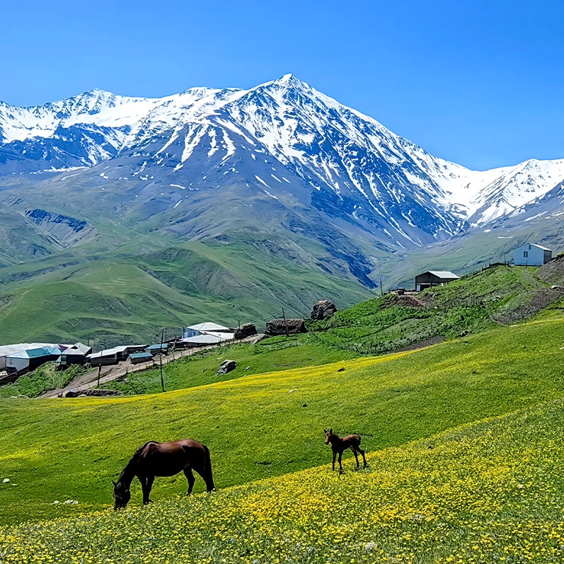
The mountain straddles the international border between Azerbaijan and Russia: the northern slope lies in the Republic of Dagestan, while the southern slope belongs to Qusar district, Azerbaijan. This location gives the mountain a natural geopolitical function in the South Caucasus. The northeast proximity to Khinalig village (around 2,170 meters, a high mountain village) and southwest near Laza village provides access points for ascents. The summit, being the highest point in both countries, holds strategic significance along the rugged border relief.
As part of the Main Caucasus range, Mount Bazarduzu connects the Caucasus mountains to surrounding plateaus and lower relief, forming a natural barrier affecting regional climate and continental migration routes. The summit is located about 7 km northeast of Kurush village in Dagestan, close to the southern border, illustrating the mountain's extension into the high relief of the South Caucasus.
Relief and Measurements
Mount Bazarduzu reaches an elevation of 4,466 meters and is the highest peak in both Azerbaijan and the Republic of Dagestan, Russia. This height emphasizes the mountain’s dominance within the Greater Caucasus and its importance along the border relief.
The mountain's topographic prominence is 2,454 meters, calculated from the main col at 2,012 meters. This substantial rise classifies Bazarduzu as an ultra-prominent peak, requiring a minimum 1,500-meter prominence to stand out independently from surrounding terrain.
The nearest higher peak is Mount Tebulosmta on the Georgia-Russia border, with an isolation distance of 259.08 kilometers. Nearby Shahdag, at 4,243 meters, is Azerbaijan’s second-highest peak, highlighting a cluster of high points along the mountain range.
Topographically, the mountain features long, steep ridge structures; the southern ridge has slopes around 30 degrees and is covered with scree and rubble. Higher elevations have continuous ice fields and remnants of Quaternary glaciers, while the northwestern slopes are largely fractured and rocky. The southern ridge provides direct access to the summit, while northeast routes and the Shahnavad valleys to the east offer alternative approaches.
Geology
Tectonic Formation
Mount Bazarduzu forms part of the Greater Caucasus range and was shaped within the Alpine orogeny. Its formation occurred during the Cenozoic as a result of the northward collision between the Arabian and Eurasian tectonic plates. This tectonic interaction created a fold-and-thrust belt in the Mesozoic-Tertiary "back-arc" region, with the pro-wedge to the south covering the Kura basin and the retro-wedge to the north covering the Terek basin. This process relates to the closure of the Neotethys Ocean and ongoing subduction along the South Caspian under the Eurasian plate.
Initial uplift began during the Oligocene with northward subduction and folding, starting compression and formation of foreland basins like the Kura basin. Major uplift occurred in the Middle Miocene, around 13–14 million years ago, raising the mountain above sea level, with accelerated deformation during the Neogene-Quaternary collision in the Pliocene. Pleistocene activity along main structures continued uplift through fault motion.
The formation processes are characterized by crustal shortening and vertical uplift; the medium-term growth rate is estimated at 0.31 mm/year since the Sarmatian stage of the Middle Miocene, reaching 0.77 mm/year during the Pliocene. Since the Miocene, total uplift exceeds 3,550 meters. This rise is primarily driven by the south-directed Greater Caucasus Thrust (>30 km of thrusts over 1,000 km) with north-directed back thrusts and transverse faults accommodating ongoing deformation. Quaternary glacial erosion shaped U-shaped valleys and moraines.
Rock Types and Characteristics
Mount Bazarduzu lies in the Tufan zone of the Eastern Greater Caucasus, with a Paleozoic metamorphic basement mainly composed of gneiss and schist forming the core. Mesozoic sedimentary layers overlay this: Middle and Upper Jurassic sandstones, schistose flysch, biogenic magnesium calcite, and layers mixed with carbonates and reef remnants. Lower Cretaceous shallow marine carbonates and turbidites, and Upper Cretaceous deep-sea sediments form the layered structure.
Marble outcrops of metamorphosed calcites, especially around Shahdag, are visible on rocky slopes and influence the rugged terrain. Minor volcanic intrusions, such as Upper Jurassic andesite-dacite-rhyolite dikes and sills (~166 million years ago), appear intermittently in the Tufan zone and relate to Jurassic volcanism.
Erosion has formed extensive scree and rubble fields, especially on steep slopes. Weathered clay-porphyry and sandstone convert into dark schist fragments, creating the summit pyramid’s characteristic appearance. Moderate metamorphism is observed in Jurassic rocks with weak schistosity, strengthening structural stability and weathering patterns.
Climate and Ecology
Climate
Mount Bazarduzu has a continental alpine climate: cold, snow-covered winters at high altitudes and relatively mild summers. At the summit (4,466 m), the mean annual temperature is below 0°C, daytime July temperatures are 5–10°C, and January nighttime lows range from −10°C to −14°C, with extremes down to −42°C to −44°C during prolonged cold periods. Annual precipitation is 800–1,400 mm in surrounding mountains, mostly as snow above 2,500 m, maintaining permanent snowfields and small glaciers.
Seasonal patterns from November to April are characterized by heavy snowfall feeding glaciers and contributing to river systems such as the Turyancha. Frequent frosts and sub-zero temperatures are common, often below −20°C, increasing ice formation risks. Summer months (June–September) experience partial snowmelt; daytime temperatures at mid-altitudes can exceed 0°C, affecting snow runoff and avalanche risk. Microclimates vary sharply with elevation and slope orientation: lower valleys are wetter, exposed ridges are drier and windier, amplifying short-range temperature differences.
Orographic effects from the Caucasus mountains determine local climate: humid air from the Black Sea and Caspian brings more precipitation to southern slopes, while northeast slopes experience rain shadows. Above 3,000 m, conditions are relatively dry. Recent climate change has accelerated glacier retreat: from 189 km² in 1960 to 88 km² in 2014 in the Eastern Greater Caucasus. Bazarduzu retains the largest glacier area, with accelerated melting since 2000, causing over 11 billion tons of freshwater loss. As of 2024, its glaciers cover approximately 3.6 km².
Biodiversity and Habitat
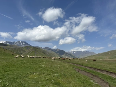
Mount Bazarduzu is located within Shahdag National Park and features vegetation zones following elevation and climate gradients. From 600–1,800 m, deciduous forests dominate, with Caucasian oaks (Quercus macranthera) and eastern beech (Fagus orientalis), with understory shrubs such as cherry and flowering species. Between 1,500–2,700 m, mixed forests of pines and junipers (Juniperus polycarpos, J. foetidissima), ash (Fraxinus excelsior), and birch (Betula pendula) occur. Above 3,000 m, alpine tundra dominates, with low grasses, annual herbs, lichens, and hardy species like Ephedra procera.
The fauna reflects the Caucasus biodiversity hotspot, including many endemic or nearly endemic species. Mammals include the Caucasian chamois (Rupicapra rupicapra caucasica), brown bear (Ursus arctos), and wolf (Canis lupus). Birds include Caucasian eagle-owl, golden eagle (Aquila chrysaetos), and Caucasian snowcock (Tetraogallus caucasicus). Azerbaijan hosts over 12,000 animal taxa; Shahdag National Park protects 88 subendemic plants and several sensitive vertebrates.
Key habitats include glacial rivers and high-mountain meadows, supporting invertebrates and amphibians adapted to cold, nutrient-poor waters. Shahdag National Park covers 130,508 hectares, with conservation measures addressing grazing, climate change, and fragmented habitats. The mountain contributes to biodiversity corridors and ecosystem connectivity for migratory species in Azerbaijan’s 11.8% forested area.
History and Culture
Name Origin and Naming
The name "Bazarduzu" comes from Azerbaijani, meaning "market square" or "market plain." It refers to medieval multi-ethnic trade fairs held in the Shahnabad valley east of the summit. These fairs were important hubs along Caucasus trade routes, facilitating commerce among different ethnic groups.
In other languages, the mountain is known in Russian as Bazardyuzü (Базардюзю), a Cyrillic transliteration of the Azerbaijani name. Locals in the region, particularly Lezgins, call it Kiçen suv; "kiçen" can mean "market" or "summit," and "suv" can mean "water" or "mountain," reflecting local significance or associations. Historical names often guided herding routes, though etymology relies mainly on oral tradition.
Historical Research
Mount Bazarduzu has long served as an important geographic landmark in the Greater Caucasus, with its name meaning "market mountain" in Azerbaijani and Russian. It points to historical trade around the summit. Passes facilitated seasonal migration and trade.
In the 19th century, Russian imperial expansion brought military conquest and treaties, such as Gulistan (1813) and Turkmenchay (1828), integrating the region administratively. Topographic and geological surveys of the Greater Caucasus were conducted, and Bazarduzu was documented for the first time. Russian topographer Aleksei Alexandrov made the first recorded ascent via the northeast route in 1847.
On July 31, 1902, Hungarian researcher Mór Déchy reached the summit from Shahdag, completing his seventh and final expedition in the Greater Caucasus. Déchy conducted studies in geology, glaciology, botany, zoology, and ethnography, collected rock samples, and took the first summit photographs. His work was published in 1907 in the book "Kaukázus," advancing European understanding of the Eastern Caucasus.
With the declaration of the Azerbaijan Democratic Republic in 1918, Mount Bazarduzu gained a geopolitical role on the new northern border with Russia. This line followed the preexisting Russian imperial Caucasus provincial boundary, with the summit directly on the Azerbaijan-Dagestan border. In 1920, prior to Soviet unification, the boundary continued the imperial frontier.
Mountaineering
First Ascents
The earliest documented ascent of Bazarduzu occurred in May 1849 by Russian military topographer Lt. Sergey Timofeevich Alexandrov via the northeast route. This climb was part of topographic studies of the Greater Caucasus. Claims of an 1847 ascent remain unverified.
The first recorded Western ascent was in August 1890 by British mountaineers George Percival Baker and George Yeld, approaching from the north-near Qemeravan valley. Their expedition documented the remote location and schistose rock, highlighting the mountain for European alpinists.
In 1902, Hungarian Mór Déchy ascended via Shahdag, furthering Central European interest in Caucasus mountaineering. Déchy’s expedition built on previous Russian and British ascents and sparked discussion about historical precedence. Winter ascents via the southeast route from Azerbaijan were first successfully completed on February 6–8, 2017, by Babek Isgandarov (Orabanli).
Access Routes and Entry
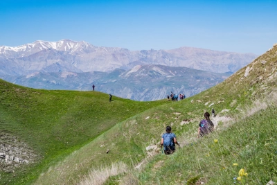
Mount Bazardüzü is generally suitable for experienced climbers, with low technical difficulty. The most popular route starts from the northeast, entering from the village of Khinalug in the Quba region. Climbers travel from Baku to Quba by bus, then reach Khinalug village by taxi or 4x4 vehicle. From there, they proceed along the Yatyqdere valley to the base camp (approximately 3,250 m) either by hiking or sliding paths. From the base camp, the ascent to the summit takes 2–3 days, with an elevation gain of about 800–1,000 m per day, and overnight stays at intermediate camps are possible.
Alternative routes are possible via Laza village in Qusar or Qəmeravan village in Qabala. From the Russian side, entry is possible through Kurush village in Dagestan, but a border permit is required.
The most favorable period is July and August, when snow is minimal on the upper slopes and technical ice climbing is not required. Essential equipment includes sturdy mountain boots, trekking poles, a climbing helmet, and warm clothing. During spring and autumn ascents, there is a risk of avalanches.
Entry permits on the Azerbaijani side are issued by the Ministry of Ecology and Natural Resources and Shahdag National Park. On the Russian side, an FSB border permit is required, which must be applied for at least three months in advance. Guided tours are recommended and often mandatory. Tourism infrastructure is developing, and eco-friendly guesthouses are available in valleys such as Khinalug and Laza, supporting multi-day expeditions.