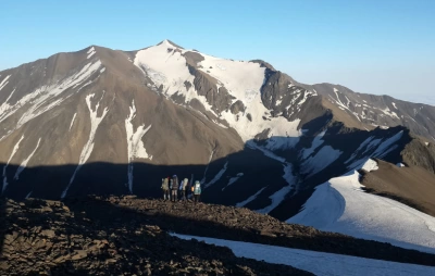
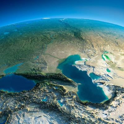
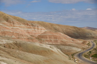
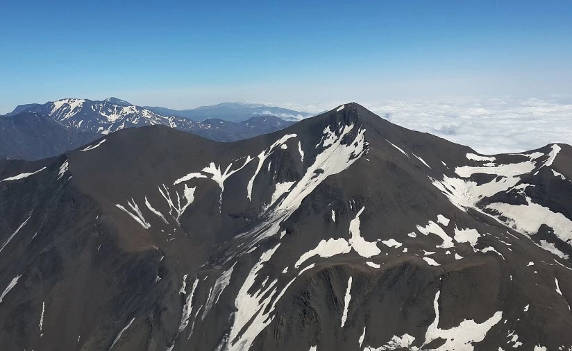
Mount Raqdan, rising to an elevation of 4,020 metres, is one of the remarkable peaks of the Greater Caucasus, located along the Main Caucasus Range. Situated in the Azerbaijan–Dagestan border region between Mount Bazardüzü and Mount Charundağ, Raqdan is distinguished by its rugged high-mountain terrain and challenging mountaineering routes. The summit can be approached via the Main Caucasus Watershed Range from the Khinalig–Bazardüzü direction, as well as through high-mountain routes from the Filfilli area. Discover detailed information about Mount Raqdan, the 4,020-metre summit, and mountaineering in Azerbaijan.
Brief Information About Mount Raqdan
Brief Information About Mount Raqdan
-
Name: Raqdan / Рагдан / Raqъдан
-
Elevation: 4,020 m
-
Mountain system: Greater Caucasus
-
Range: Main Caucasus Watershed Range
-
Location: Azerbaijan–Russia border region
-
Azerbaijani side: Gabala District
-
Nearby peaks: Mount Bazardüzü and Mount Charundağ
-
Coordinates: 41°11′36″ N, 47°45′20″ E
-
Associated river system: Raqdanchay
-
Raqdan glacial complex: 3 glaciers
-
Classic mountaineering route: Grade 2A
-
Raqdan traverse: Grade 2B
-
Main rock types: Schist and rocky outcrops
Mount Raqdan rises along the Main Caucasus Watershed Range, which extends through one of the highest and most challenging mountainous areas of the Greater Caucasus, along the Azerbaijan–Dagestan border. Reaching an elevation of 4,020 metres, the peak lies between Bazardüzü and Charundağ, making it one of the most remarkable 4,000-metre peaks in the Eastern Caucasus.
Raqdan's geographical position makes it more than just another high mountain summit. It is located along this section of the Main Caucasus Watershed Range, within Gabala District on the Azerbaijani side and the mountainous region associated with the Republic of Dagestan, Russia, to the north.
Between Bazardüzü and Charundağ
The section of the range where Raqdan is located is one of the highest mountain junctions in the Caucasus. Here, the Main Caucasus Range rises above 4,000 metres. Various geographical sources identify Bazardüzü (4,466 m), Charundağ (4,079 m) and Raqdan (4,020 m) among the principal high peaks in this area.
Raqdan lies precisely between Bazardüzü and Charundağ. As a result, the summit has a direct geographical connection with both Azerbaijan's highest mountainous terrain and the high-mountain system of southern Dagestan.
The Meaning of the Name “Raqdan”
Russian-language sources offer an interpretation linking the name Raqdan to the Lezgian word “рагъ”, meaning “sun”. Based on this interpretation, the name is sometimes poetically rendered as “Sun Summit”.
However, it is more accurate to present this as a possible etymological explanation rather than a definitive scholarly translation. Mountain names can have different local and oral interpretations, which may not always correspond to established linguistic and toponymic research.
Raqdan – Glaciers and High-Mountain Landscapes
One of Raqdan's most interesting features is its glacial system. Scientific sources examining the high-mountain landscapes of the Eastern Caucasus identify a distinct Raqdan glacial complex containing three glaciers. These glaciers contribute to the formation of the high-altitude water systems within the Samur River basin.
Approximately 2.2 kilometres east of the summit lies a high-mountain glacial area. Sources indicate that this area contains a point above 3,500 metres that does not have a separately designated name on maps. This point is recognised as the southernmost point of Russia.
This geographical feature makes Raqdan an interesting subject not only for mountaineering but also for border geography and cartography.
Raqdan – A Technical Summit for Mountaineers
One of the most interesting references to Raqdan appears in G. I. Anokhin's book Восточный Кавказ (Eastern Caucasus), published in 1978. The work is an important source providing detailed descriptions of the mountainous regions, passes and mountaineering routes of the Eastern Caucasus. Anokhin lists Raqdan's elevation as 4,019 metres and classifies the ascent to the summit as Grade 2A.
According to the book, the ascent along Raqdan's southern ridge is relatively steep. Rocky terrain and schist formations dominate the summit area. Anokhin specifically notes the presence of rock-crystal outcrops among the schist near the summit. The ridge traverse beyond the summit is considered more demanding and is classified as Grade 2B.
Approaching Raqdan from the Azerbaijani Side
There are several possible approaches to Raqdan from the Azerbaijani side. One route begins in the village of Khinalig, climbs towards Bazardüzü and then reaches the Main Caucasus Watershed Range before continuing in the direction of Raqdan. The high-altitude terrain, considerable distance and severe weather conditions mean that this approach requires thorough preparation.
Another important approach is from the direction of Filfilli village in Oghuz District. Older mountaineering and mountain tourism sources describe routes ascending through the Ahchay Valley from Filfilli and reaching the Main Caucasus Watershed Range. One of the routes described by Anokhin is associated with high-mountain itineraries beginning in Filfilli, crossing Charin Pass and continuing towards the Charundağ–Raqdan area.
An interesting aspect of the Filfilli approach is its historical significance. Mountain passes and trails in this area once connected Azerbaijani villages with high-mountain settlements in Dagestan. An older source mentions mountain paths used between Filfilli and the Dagestani villages of Maza and Ixir.
Thus, two principal approaches to Raqdan from the Azerbaijani side can be identified: the Khinalig–Bazardüzü–Main Caucasus Watershed route and the Filfilli–Ahchay Valley–Main Caucasus Watershed route. Both cross high-mountain terrain and are characterised by long distances, challenging topography and technically demanding sections.
Raqdan's significance in mountaineering begins precisely here. It is not simply a mountain rising above 4,000 metres; its surrounding ridges, rocky passages, glacial areas and technical traverses make it one of the most interesting mountaineering objectives in the Eastern Caucasus. Anokhin's classification of the classic ascent as Grade 2A and the subsequent summit traverse as Grade 2B clearly illustrates this.
The high-mountain zone between Raqdan, Charundağ and Bazardüzü is also one of the highest sections of the Eastern Caucasus. Mountain tourism sources note that Charundağ, Raqdan and Bazardüzü all exceed 4,000 metres along an approximately 24-kilometre section of the Main Caucasus Range extending from Malkhamud to Bazardüzü.
The Rocky World of Raqdan
Raqdan's geological and geomorphological structure is also noteworthy. Anokhin describes schist formations and rocky outcrops around the summit. In some sections, fractured rock and steep rocky formations increase the technical difficulty of the route.
Geological studies of the Raqdanchay Valley also demonstrate that the area is not only a high-mountain landscape but also a region of considerable geological interest. Scientific research has examined various rock formations and mineralisation zones within the Raqdanchay Valley.
Raqdanchay
The name Raqdan is associated with more than just the mountain itself. Raqdanchay originates in a high-mountain glacial area east of the summit. Russian-language geographical sources indicate that the river subsequently becomes a tributary of the Mullarçay River.
In this respect, the Raqdan area is part of the high-mountain zone where both watershed systems and glacier-fed rivers of the Main Caucasus Range originate and develop.
Wildlife Around Raqdan
The high-mountain terrain surrounding Raqdan forms part of the Eastern Caucasus's rich natural landscapes. Sources highlight the region's alpine vegetation and diverse wildlife. Caucasian snowcocks and mountain goats can be found in this area.
Raqdan and Azerbaijan's High Peaks
Raqdan holds a distinctive position among Azerbaijan's highest peaks. The area, which contains several summits exceeding 4,000 metres, forms part of the highest section of the Greater Caucasus in northwestern Azerbaijan.
-
Bazardüzü – 4,466 m
-
Charundağ – 4,079 m
-
Raqdan – 4,020 m
These three peaks form an important cluster of high summits located close to one another along the high-mountain section of the Main Caucasus Range near the Azerbaijan–Dagestan border. Geographical sources from both Russia and Azerbaijan also identify these peaks among the principal 4,000-metre summits of the Eastern Caucasus.
Why Is Raqdan Worth Exploring?
Raqdan's significance lies in more than its elevation of 4,020 metres. Its high-mountain terrain, glaciers, the Main Caucasus Watershed Range, the geographical setting of the Azerbaijan–Dagestan border, the Raqdanchay Valley and classic mountaineering routes all come together in one remarkable area.
Raqdan is also one of the Caucasus peaks that is clearly visible on maps but has not yet become part of widely established tourism itineraries. Together with Bazardüzü, Charundağ and the Mullar Valley, the surrounding landscape forms one of the most fascinating high-mountain regions of the Eastern Caucasus.