Bazardüzü Mountain (4466 m) is the highest peak of the Republic of Dagestan and neighboring Azerbaijan. This mountain is known for its steep cliffs and ice cover, extending south and east toward Azerbaijan, and north and west toward Dagestan. At the same time, this peak serves as a natural boundary marker. Its height ensures the presence of permanent snow and glaciers on the steep slopes. In Azerbaijan, Bazardüzü Mountain is located on the border of the Qusar and Qabala districts. Some tributaries of the Turyan, Yatıqçay, and Şahnabatçay rivers originate from Bazardüzü Mountain. In the Qusar district, Yatıqçay and Şahnabatçay are called Qusarçay. From the Dagestan side, some tributaries of the Samur River are fed by waters coming from Bazardüzü Mountain.
The harsh winter climate ensures that snow remains year-round on the mountain’s sections above four thousand meters. On the Dagestan side, areas at an altitude of 4300 meters are covered with glaciers throughout the year.
Bazardüzü Mountain Toponymy and History
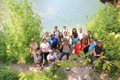
The toponymy of Bazardüzü Mountain is not fully clear. Some sources call it Tikisar – “High Head.” Among the peoples of Dagestan, the Lezgins refer to this peak as Kiçevnədaq, meaning “Mountain of Terror.” In Turkish, Bazardüzü translates as “market square” or, more specifically, “turn to the market.” In the Middle Ages, and likely in earlier periods, large, multicultural fairs were held in the high-mountain Azerbaijani valley of the Şahnabatçay River, located east of this peak. These fairs brought together not only neighboring peoples of the Eastern Caucasus – the people of Xınalıq, Qriz, and Budukh – but also Lezgins, Rutuls, Saxurs, Avars, Laks, Dargins, Kumyks, Nogais, and Azerbaijani merchants. Georgians and Armenians also participated in these markets. Merchants from the Near and Middle East – Arabs, Jews, Persians, and Indians – came here to trade. At these fairs, items such as metal and woodcraft from Lahij artisans, handmade products from Dagestan weavers, Damascus weapons, livestock, horses, and agricultural products were bought and sold. On the way to the fair, the main landmark – Bazardüzü Mountain – was visible from afar. Positioned higher than other peaks, its glacier-covered walls served as a guide for caravan traders. When caravans saw the Bazardüzü peak, they knew to turn left, as the fairgrounds were just beyond a nearby grassy pass. Historical sources indicate that traces of fairs held at the mountain’s foot in summer remain to this day. The presence of historical cemeteries and traces of ancient caravan routes in the region confirm the existence of active trade. It is believed that the fair area extended to the Şahnabatçay, where Bazaryurd mountain slopes hosted tent camps for merchants.
The historical caravan routes leading to the market followed these directions:
- Dagestan – Derbend – Kurush village – Shahyaylaq
- Derbend – Laza village – Shahyaylaq
- Baku – Shabran – Gonaqkend – Xınalıq village – Shahyaylaq
- Gobustan – Xaltan village – Gonaqkend – Xınalıq village – Shahyaylaq
- Shamakhi – Lahij – Qalacıq village – Hapıt village – Xınalıq village – Shahyaylaq
- Sheki – Qabala – Laza village – Shahyaylaq
- Sheki – Qabala – Qəmərvan village – Shahyaylaq
Merchants traveling these routes conducted trade and contributed to the development of economic and cultural ties among different peoples.

First Documented Ascents of Bazardüzü
The first documented ascent of Bazardüzü peak was in May 1849 by Russian topographer Sergey Timofeevich Alexandrov. He climbed from the Kurush pass toward the northeast ridge, reached the summit, and installed a topographic marker. In the winter of 1873, under the leadership of K. Alexandrov, Russian topographers ascended Bazardüzü and installed a triangular tower at the summit. Despite harsh weather conditions, the expedition was successful.
In August 1952, Candidate of Historical Sciences G. I. Anokhin ascended Bazardüzü using the same route. In September of the same year, he successfully climbed the Bazardüzü ice wall for the first time, a major achievement for that era. By 1952, Anokhin was already an experienced mountaineer who had conquered numerous Caucasus peaks. His expeditions on Bazardüzü included relatively easier routes from the southern slope and extremely difficult routes from the northern side. Anokhin established climbing routes along the ice wall, either alone or with beginner mountaineers, expanding the paths to the summit.

Modern Ascents
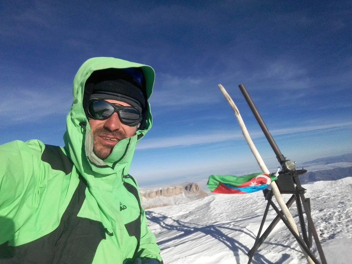
On August 29, 1993, a group of Azerbaijani mountaineers, led by the renowned climber Elman Mubariz oglu Rahimov, successfully ascended Bazardüzü via the South Ridge route (difficulty 1B). On February 7-8, 2017, Babek Agabala oglu Isgandarov (Orabanlı) became the first climber to solo the peak during winter via the southeast route. He started the ascent from the Hydrological station in Shahyaylaq. Despite heavy snow, he chose the southeast route, followed the watershed, and reached the summit. The descent was made via the traditional southern route, completing the climb at the Hydrological station.