On July 31, 1902, the Hungarian explorer Mór Déchy reached Bazarduzu, the highest peak in Azerbaijan, making a remarkable step in mountaineering history. By ascending this peak, he fulfilled his passion for exploration and adventure, deeply experiencing the breathtaking scenery around him.
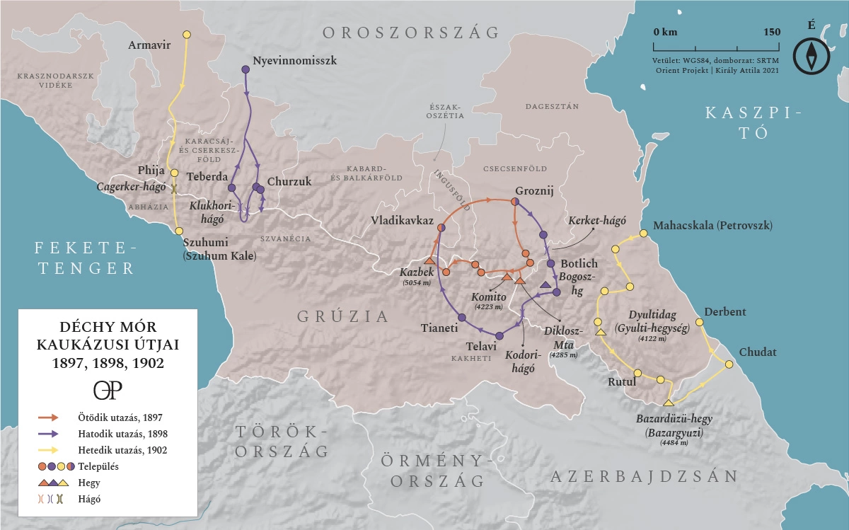
The travel map of Déchy Mór's 1902 expedition to Mount Bazarduzu.
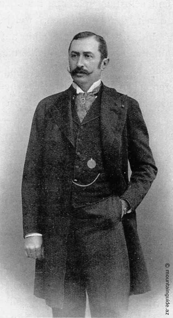
Mor Déchy (1851-1917)
Now, the highest peak of Bazarduzu can be seen, and everything below it seems to be left behind. To the north, descending from the glacier-covered mountain walls, we cannot imagine a more wild and beautiful view... The enormous peak, which dominates everything, attracted me immensely. I had one wish: to step on the magnificent mountain peak. I forgot about scientific research and all other goals.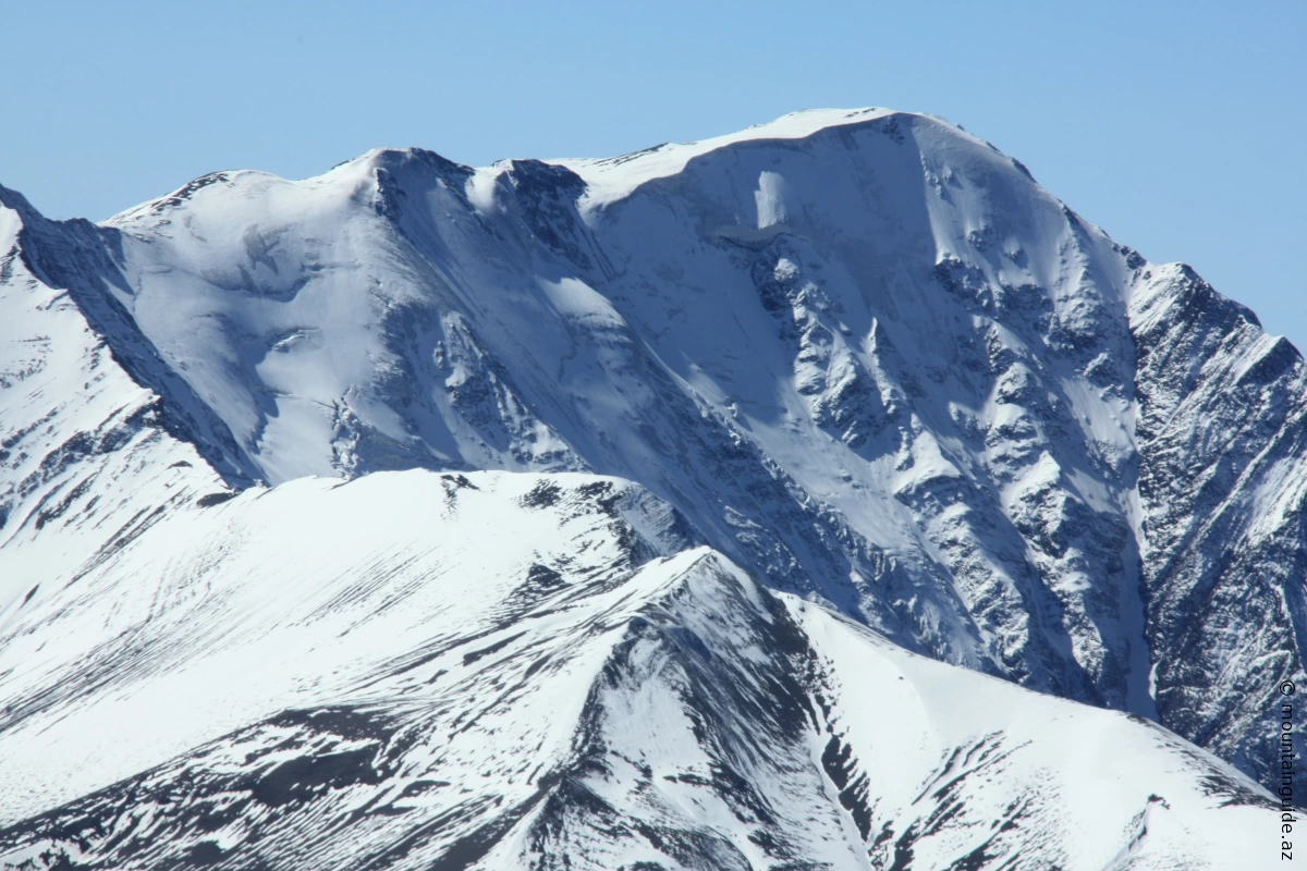
Bazarduzu 4466 m
On July 31, 1902, at 10:35 AM, Mór Déchy reached the highest peak of Bazardüzü, which is covered with glaciers in Azerbaijan. Born in Pest, he received an excellent education and later became a geographer and mountaineer, although his family had intended for him to become a lawyer.
His passion for mountaineering was determined at the age of 18, during his first expedition in the Swiss Alps. By the age of 20, he had already climbed the summit of Mont Blanc, and at 21, despite his young age, he was one of the founders of the Hungarian Geographical Society.
He made his first trip to Asia at the age of 28, visiting the tomb of Sándor Kőrösi Csoma in Darjeeling. Following in the footsteps of the extraordinary-willed linguistic researcher, he suffered from malaria for six weeks and almost lost his life. (Sándor Kőrösi Csoma had died of malaria).
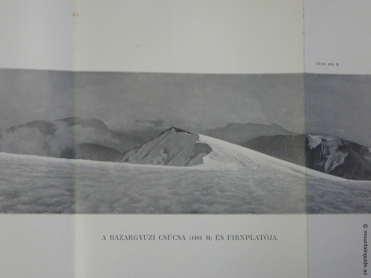
Photo from the peak of Mór Dechy Bazarduzu
In 1884, he organized his first Caucasus expedition. After climbing Elbrus, he dedicated his entire life (and a significant portion of his family’s wealth) to exploring the Caucasus. Over 18 years, he led seven expeditions and visited all the central mountain ranges of the Caucasus. On his seventh and final research trip, he reached the summit of Azerbaijan. On July 3, 1902, at 10:35 AM – as he emphasized in his book.
The Caucasus enthusiast Déchy's work has been published in numerous high-quality editions in Hungarian, English, and German. His work "Caucasus" (My Researches and Experiences in the Caucasus Mountains) remains one of the most comprehensive descriptive works ever written about the mountains. His photographs preserve unique values not only in natural geographical subjects but also in an ethnographic sense.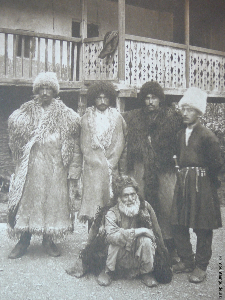
Caucasian shepherds (photo Mór Déchy)
The president of the German Geographical Society, Professor Ferdinand von Richthofen, directly claimed that, thanks to Déchy's scientific writings, the Caucasus became the most thoroughly researched mountain range outside of Europe. His book, which condensed everything into one volume and was beautifully illustrated with magnificent photographs, covered the geological structure, hydrography, glacial processes of the mountain range (he had researched all the glacial areas of the range), as well as topics on botany, fauna, and, of course, the peoples living there. He had brought along several Hungarian scholars who made significant contributions to the scientific study of the high mountain environment. (Mór Déchy, botanist Hugo Lojka, geologist Ferenc Schafarzik, geologist Karoli Papp, and botanist Laszló Hollos reached the Caucasus.) He was also recognized by the most important geographical societies for his work. In addition to the French and German Geographical Societies, the Royal Geographical Society (UK) accepted him as a member, and he was also awarded the honorary doctorate of Kluj-Napoka University. A significant portion of his collection was donated to the Hungarian National Museum and the Hungarian Royal Collection. He bequeathed his collection to the Geological Institute, and his library was given to Debrecen University.
Climbing the summit of Azerbaijan
In connection with his commitment from 110 years ago, he asked the famous geologist and educator Dezső Laczkó from Veszprém to lead the collection work for the expedition. (Ensuring progress in difficult terrain was the task of two Tyrolean mountain guides.) On July 25, 1902, they left the city of Akhti in Dagestan and reached the Azerbaijani border in three days.
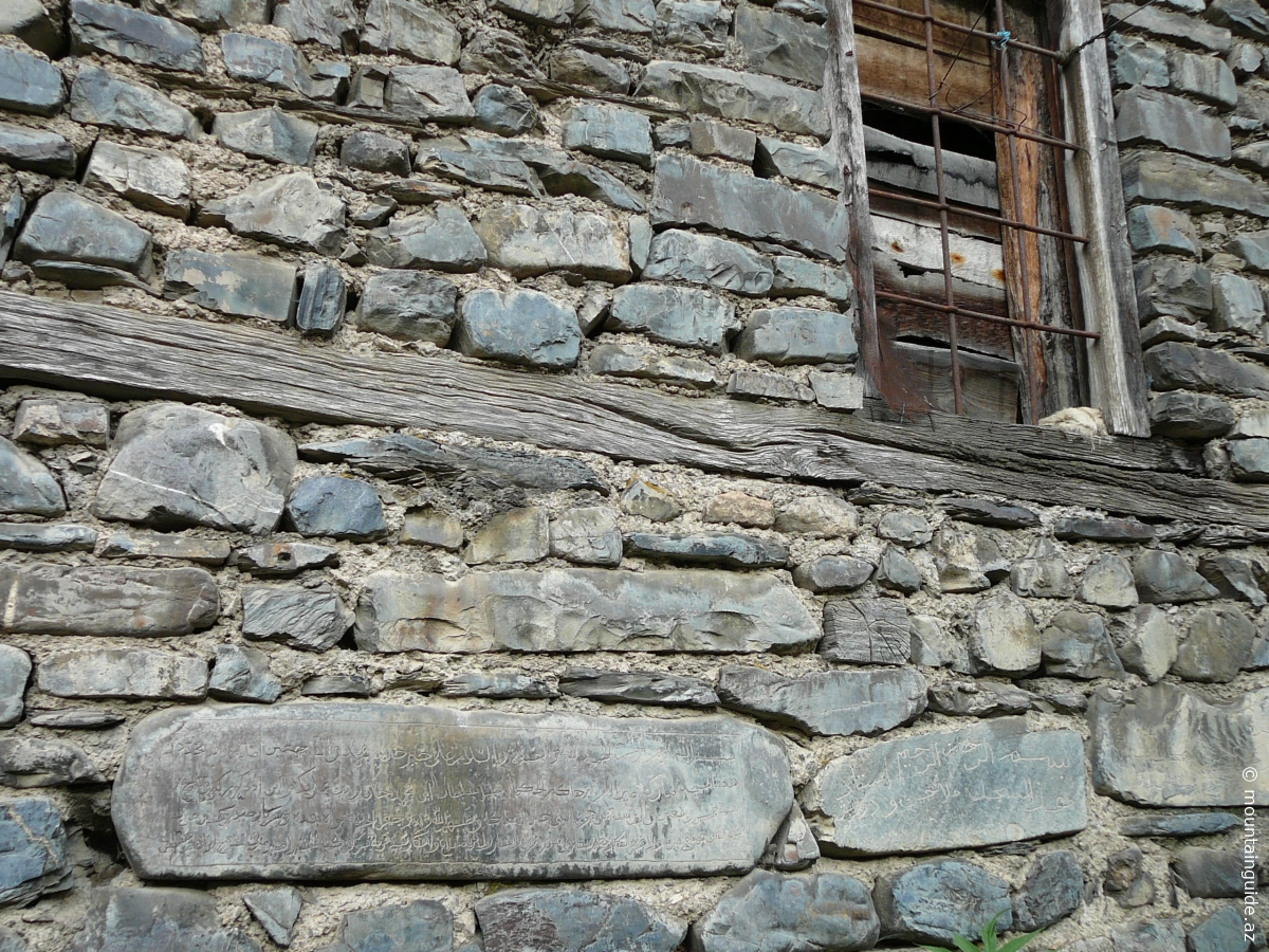
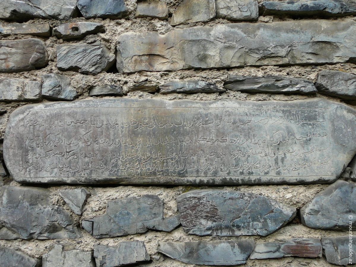
Ancient house with Arabic inscription
In his lines recording daily events, Dechi gave a vivid description of the Khinaliks living here, noting that the Lezgins considered themselves descendants of the Koreyish (the tribe of the Prophet Muhammad).
 He wrote about the shepherds of the Caucasus: "Among them, a certain prosperity prevails, which is owed to their beautiful pastures and sheep farming. Most of them can read and strictly follow the commands of the Quran." They set up their base camp at an altitude of 2700 m. Here, only "shepherds" were visible, and they still used ancient yurts (yurts) to effectively protect themselves from extreme weather conditions.
On July 30, 1902, they were already setting up camp at an altitude of 3751 m, on a glacier-covered (!) stone plateau. From here, one could see the highest and perhaps the most scenic mountain giants of present-day Azerbaijan: the "table" of Shahdagh at an altitude of 4243 m, the summit of Mount Tufan (Storm Mountain) at 4195 m, and the side of Bazarduzu.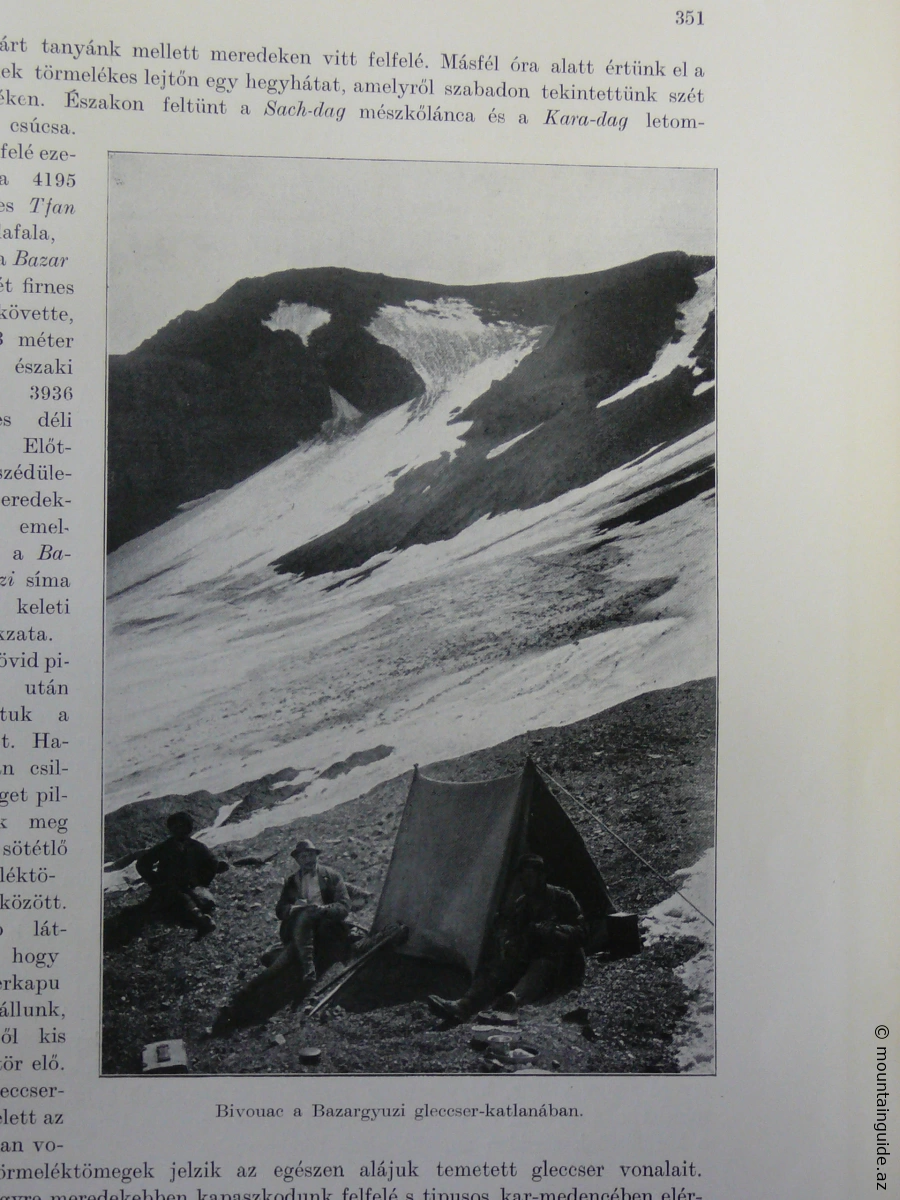
Déchy Mórun camp under the Bazarduzu
Déchy Mór noted about his camp at the base of Bazarduzu: "In this mountain range, the Caucasus range finally rises above the snow line, as if it wanted to demonstrate its dominant power once again before sinking into the Caspian Sea, which is now so close."
The days spent in snow, frost, and ice did not diminish the enthusiasm for research of the then 51-year-old "glacier researcher." With the elegance typical of the dualism era, he only mentions the harsh conditions once: "While lying on that harsh bed, in the cold that could hardly be called pleasant, I wondered how suitable it is for a camp to be set up in such open air, on the ice, in freezing temperatures, and how we can provide ourselves with the comforts of art."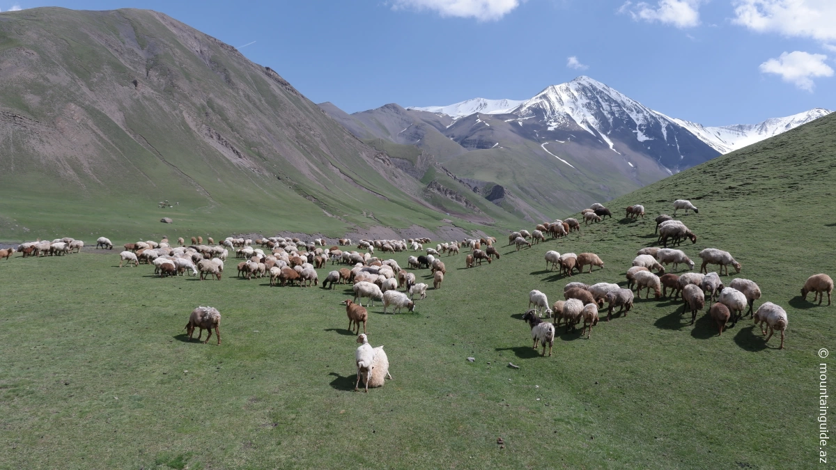
Shahyaylag
The successful summit ascent began on July 31, 1902, at 5:00 AM. The weather was favorable: the thermometer had risen to +3°C, and within less than an hour, steps had been carved through the frozen snow. The Hungarian explorer was greeted at the summit of Azerbaijan by clear, changeable cloudy weather and complete calm (!).
"At 10:35 AM on July 31, I reached the highest point... my distant goal at the eastern edge of the mighty Caucasus... First, I looked at the terrifying abyss below, then I gazed around at the world of mountains rising around me. I wanted to leave indelible impressions of the distant views in my memory," Déchy wrote about the first moments at the summit.
They rested on the summit of Azerbaijan for an hour. During their short celebration, a small bottle of wine was found in the food bag... Then, they took mandatory measurements, collected petrological samples, and began preparing photographic documentation. His photographs are among the first taken of Bazarduzu. (Perhaps he was the first to take a photo here? This would require further research.)
In the Kuszár-csáj region, Enen (perhaps due to the lyrical beauty of the landscape), the Hungarian explorers traveled through the Kuszár-csáj valley (now called Qusarçay in modern Hungarian maps) to Gusar, then to Khudat, on the shores of the Caspian Sea. On the way, they passed by several settlements located in rich pastures, where shepherds looked at the strange young men equipped with ropes, ice axes, and spiked boots with great amazement...
110 years later, the picturesque landscape of Kusarchay and the glacier valleys that open from it became Azerbaijan's first ski paradise. Visitors who came here in 2012 could see the construction of impressive (in fact, surprisingly impressive!) ski resorts, ski slopes, and related infrastructure at the foot of the eternally snow-covered mountains. Now, in many places, paved roads lead to what were once inaccessible mountain villages, and allow travel to former fortified village areas built among the clouds, such as the scenic Khinalig .
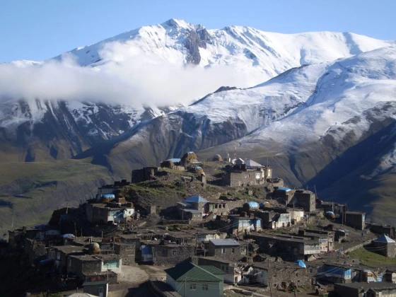 Khinalig village
The Summit of Azerbaijan is Bazarduzu, but even more beautiful and picturesque high mountains around it may await more foreign guests in the future. Among the visitors, there will surely be Hungarians. Hungarians can say: thanks to Mór Déchy, this region is not so unfamiliar to us. In fact, as we flip through his magnificent work, the sky's towering peaks greet us with a somewhat familiar appearance.
Hungarian mountaineers have a permanent place in their interest in the mountains of Azerbaijan, thanks to Mór Déchy. Deeply in love with the Caucasus, Déchy demonstrated his admiration and research enthusiasm by traveling to the Caucasus seven times. As a result of these expeditions, he thoroughly explored the rich nature of the Caucasus and its mountains in his extensively German-written books "My Research and Experiences in the Caucasus Mountains" (1907) and "Der Kaukasus. Reisen und Forschungen im Kaukasischen Hochgebirge" (3 volumes, 1905-1907). The southern Caucasus, which Mór Déchy traversed and left great marks upon, still carries his scientific and adventure-filled traces today. As we remember this great mountaineer, we express our gratitude and appreciate his respect for the Caucasus. Thanks to this invaluable contribution, the Caucasus mountains remain a source of inspiration for world mountaineers and researchers.
Proudly,
Norbert
Photos: Mór Déchy, Ministry of Culture and Tourism of the Republic of Azerbaijan, Norbert Gőgös
Source: Mór Déchy: The Caucasus – My Research and Experiences in the Caucasus Mountains, Athenaeum Literary and Printing Co., Budapest 1907. Dénes Balázs: Encyclopedia of Hungarian Travelers, Panorama, Budapest 1993.
All black-and-white photographs and quotations used in this article are from Mór Déchy.